NOAA Buoys Stations & Ships 1.5.3
Paid Version
Publisher Description
NOAA Buoys Stations & Ships - Marine & Fishing charts - the power of a GPS plotter in the palm of your hand
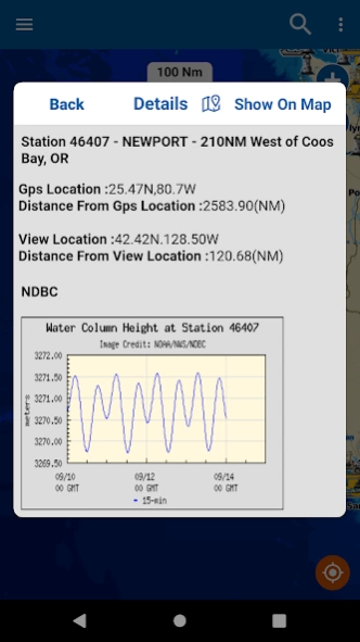
NOAA Buoy data viewer allows you to retrieve info like tides, wave height and period, wind speed and direction, air and water temperature, humidity, dew point, atmospheric pressure, rising and falling indicator, visibility, tsunami and typhoon warnings on the detailed marine chart thanks to viewer.flytomap.com
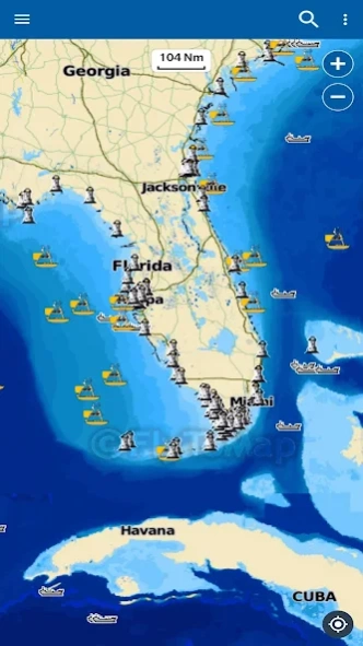
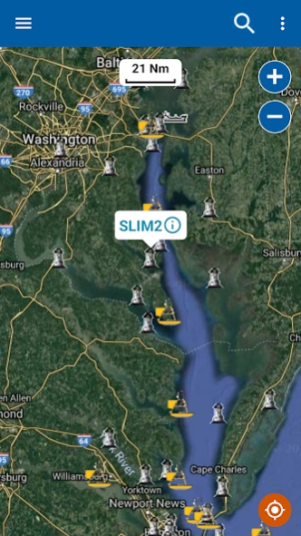
All buoy stations & ships are displayed on the world map based on the user’s current location while boating.
Sailors & Mariners can find the nearest buoy station &ships showing station name, ship name, date, time along with their respective icons.
Just tap and get the info you require.
Advise and info are coming directly from NOAA's National Data Buoy Center.
A must for boaters, sailors, anglers and divers.
Detailed Features:
* User friendly and easy to handle
* All buoy stations and ships are shown on the map based on the user’s current location
* By taping on the Icons detailed information is displayed
* By taping on GPS Icon the present location on the map is shown
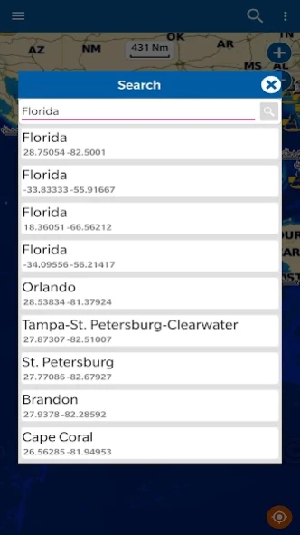
* Detailed live buoy data with access to location specific forecasts.
* Buoys sorted by proximity to your selected location.
* Tide Predictions.
* Moon phases.
* Zoom, Rotate and Pan fast just by a finger touch.
Follow us:
▶Twitter @flytomap
▶Web Site flytomap.com
▶Web App viewer.flytomap.com
▶Facebook facebook.com/flytomap
**For the buoy locations available on NOAA BUOY app, go here: http://www.ndbc.noaa.gov/
NOTE :
“ The information provided on this app is for reference only .”
“ Continued use of GPS running in the back ground can decrease battery Life”
“Turn off GPS when not in use”
About NOAA Buoys Stations & Ships
NOAA Buoys Stations & Ships is a paid app for Android published in the Geography list of apps, part of Education.
The company that develops NOAA Buoys Stations & Ships is FLYTOMAP INC. The latest version released by its developer is 1.5.3.
To install NOAA Buoys Stations & Ships on your Android device, just click the green Continue To App button above to start the installation process. The app is listed on our website since 2022-01-06 and was downloaded 2 times. We have already checked if the download link is safe, however for your own protection we recommend that you scan the downloaded app with your antivirus. Your antivirus may detect the NOAA Buoys Stations & Ships as malware as malware if the download link to com.flytomap.marineapp.worldviewer.noaabuoy is broken.
How to install NOAA Buoys Stations & Ships on your Android device:
- Click on the Continue To App button on our website. This will redirect you to Google Play.
- Once the NOAA Buoys Stations & Ships is shown in the Google Play listing of your Android device, you can start its download and installation. Tap on the Install button located below the search bar and to the right of the app icon.
- A pop-up window with the permissions required by NOAA Buoys Stations & Ships will be shown. Click on Accept to continue the process.
- NOAA Buoys Stations & Ships will be downloaded onto your device, displaying a progress. Once the download completes, the installation will start and you'll get a notification after the installation is finished.
